100% Local Flavor Tour
The “Berber Flavors and Colors of Souss Massa” tour is a discovery trail of Traditional Activities ( Cooperatives linked to the Argan grove , Olive, Honey, Crafts, etc.) and the Heritage of our region. You will also have the opportunity to admire the Architectural Heritage ( Medina of Tiznit , Kasbah and Collective Granaries ) and Natural Heritage ( Coast , Biosphere Reserve of the Arganeraie – Western High Atlas ) as well.
Day 01
45mn 50 Km

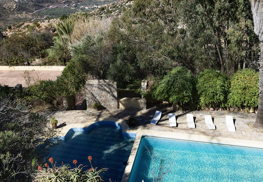
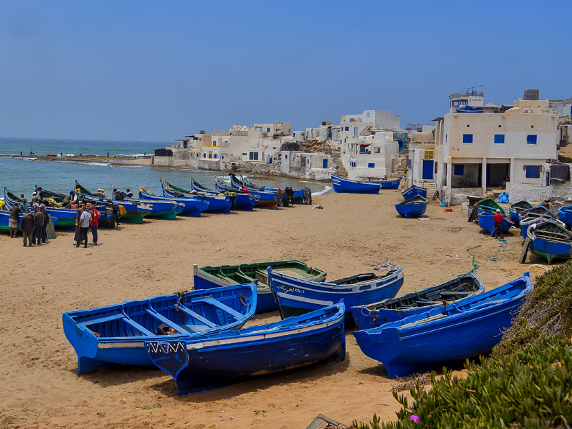
From Agadir, follow the N1 road southbound towards Tiznit and head for the beach of Sidi R’bat (30.085687, -9.663549): 1 – From the village, go north, on foot for a walk to the seaside troglodyte houses. 2 – Walk along the beach to the south – Sidi Binzarne to observe several species of birds (migratory birds, wading birds, etc.) in the mouth of Oued Massa. For the lunch break, you can join Massa (30.003710, -9.641104) where you will find a souk (Tuesday) and where you will have the opportunity to visit the basketry cooperative in Tigmi Lejdid. After lunch, head in the direction of Sidi Wassay (30.054924, -9.685929) then take the road to Sidi Boulfdail (29.983880, -9.721957). Here you see an incredible landscape of dunes where it is recommended you take a break by the ocean. At the end of the afternoon, you have the possibility of returning to the village of Jouaber (29.939595, -9.641018) to visit a goat breeding cooperative which will offer you a tasting of the different cheeses produced there. At the end of this long day, the Medina of Tiznit can be a very good resting place. You will find many accommodations there.
Points of interest:
- Fishing villages, troglodyte houses
- Bird watching – Oued Massa
- Discovery of cooperatives
Day 02
2h40mn 130 Km
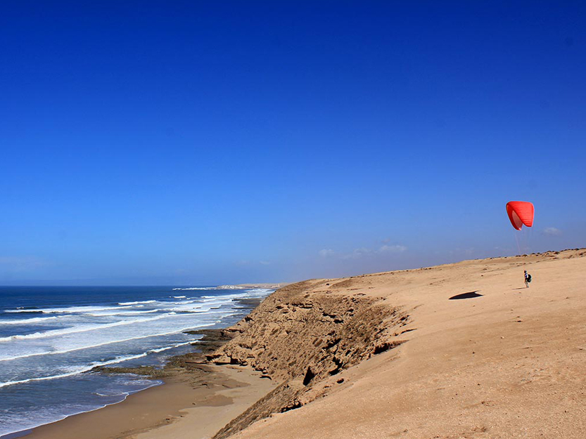
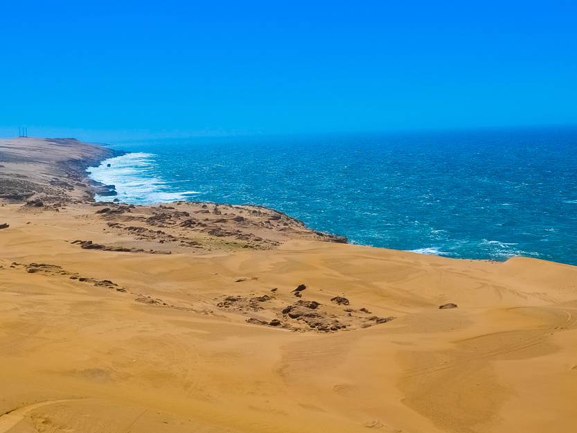
After your breakfast, you can plan the following route: Tiznit – Tifnit – Souss Massa National Park – Aourir – Tamri. From Tiznit, you leave for Tifnit (30.200660, -9.641788) by taking the N1 road. Tifnit is a small fishing village with a few cave houses. Nearby, you will find the Rokein animal reserve – Souss Massa National Park to observe antelopes, gazelles and ostriches typical of the Saharan fauna (30.289780, -9.561282). Then, you will head north, past Agadir. The villages of Aourir or Tamghart are good stops to taste a tagine and stroll along the beach. After this break, follow the coastal road north to Tamri. Once you have passed the village of Taghazout (surf capital), you will see beautiful beaches with fine sand and sparse vegetation (euphorbias and some argan trees). Cap Ghir marks the end of Agadir Bay and is a recommended stopover to take photos of the bay (by climbing to the vantage point). Once you’ve arrived in Tamri , go for a walk on the adjoining beach (30.710816, -9.857668) at the mouth of the oued, where you will be able to see many migratory birds as well as bald ibis. You can find accommodations in Tamri or in the villages located just before Cap Ghir.
Points of interest:
- Souss Massa National Park / Rokein Reserve (antelopes)
- Tifnit village
- Coastal road ( beaches north of Agadir , surf spots , Cap Ghir lighthouse)
- Banana plantation of Tamri
Day 03
1h00mn 40 Km


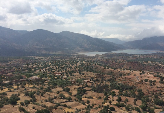
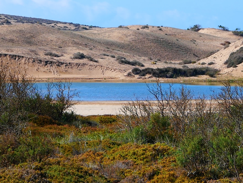
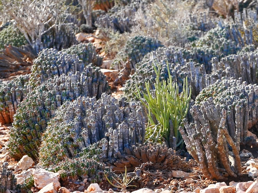
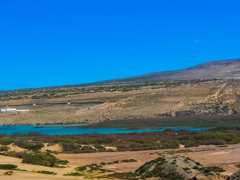
From Tamri , take the N1 coastal road north. After a few kilometers, follow the P1000 to the right which brings you to the reservoir of the Prince Moulay Abdellah dam (created in 2002). You can plan a picnic or a game of fishing : where you can catch silver carp, black bass, sun perch. You will need to organize the fishing activity in advance (ask your hosts in Tamri). There is a second optio: after discovering the lake, you can go to Imsouane bay, surely one of the most beautiful bays in Morocco (Unmissable viewpoint: 30.835405, -9.800349) where you can enjoy delicious grilled fish at the port and jetty. If you come back to Tamri, there is also a possible stopover in a dune area: 30.764265, -9.822118 (great for kids and for watching the sunset). Dinner and an overnight in Tamri or Imsouane is possible.
Points of interest:
- Dune landscape and typical vegetation (Euphorbia)
- Discovery of the foothills of the Western High Atlas
- Relaxation at Prince Moulay Abdellah Lake
- Discovery of Imsouane bay
Day 04
3h00mn 150 Km
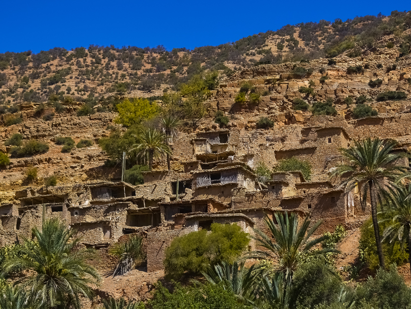

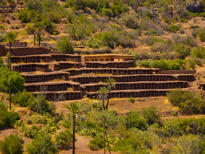
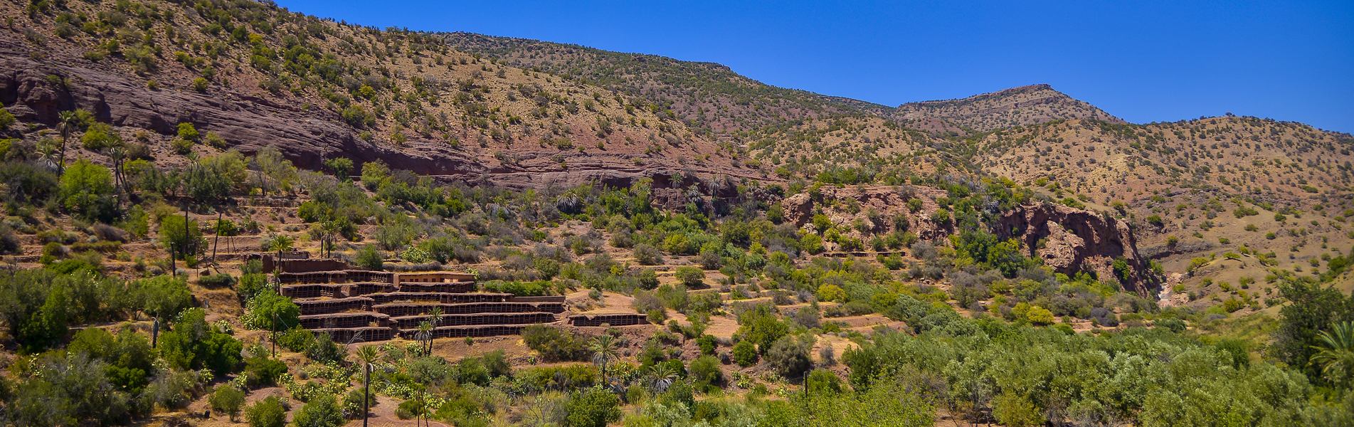
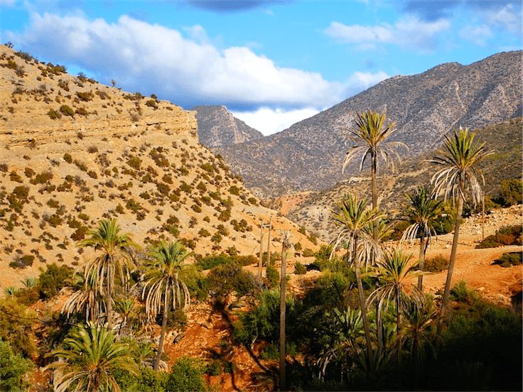
Itinerary of the day: Tamri – Timkti— Tiskji – Imouzzer Departing from Tamri, take the P1002 (eastbound) along the Tamri oued with its banana plantations and palm groves. Continue along the road towards Aksri: 30.735297, -9.532742 (weekly souk: Monday), as the landscapes of the Western High Atlas follow one another there is a mixture of argan trees, gorges and mountain oases. Then, take the P1000 at Taba (30.733367, -9.610796) and join Targa Injaaf (30.683867, -9.536302), turn right to discover the oasis of Timkti (30.668736, -9.523806) or left to continue towards the village via Imouzzer from Ida Outanane. Continuing towards Imouzzer, there is the palm grove in Tiskji (30.680967, -9.512139) and its beautiful stone village. Take your lunch break at Imouzzer. After lunch, the route is as follows: Imouzzer – Tikki – Inzerki – Tazarine Take the P1001 (road to Tiqqi 30.745460, -9.329640), you cross the SIBE of Ain Asmama which is on a plateau covered with an oak forest and thuriferous juniper stands. At the Tiqqi plateau, you have a panoramic view over the entire valley around the Abdelmoumen dam. After Tikki, turn left (30.745939, -9.319517) towards Inzerki where the largest and oldest traditional collective apiary in the world is located . The road is dotted with small typical villages. Take the opportunity to visit the apiary (30.801344, -9.176583) and its museum with a member of the village association. There is the possibility of tasting local products including the different honeys from the apiary. Then, find the N8 road (30.791706, -9.143126) and take the P1001 on your right (30.711665, -9.216699) to head in the direction of Tazarine where you can stop in the middle of the Arganeraie Biosphere Reserve – Western High Atlas.
Points of interest:
- Land of Ida Outanane
- Mountain villages and oases
- Visit of the Inzerki Collective Apiary
- Arganeraie Biosphere Reserve
Day 05
2h30mn 70 Km
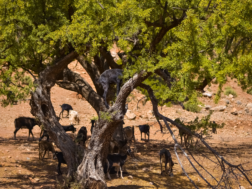
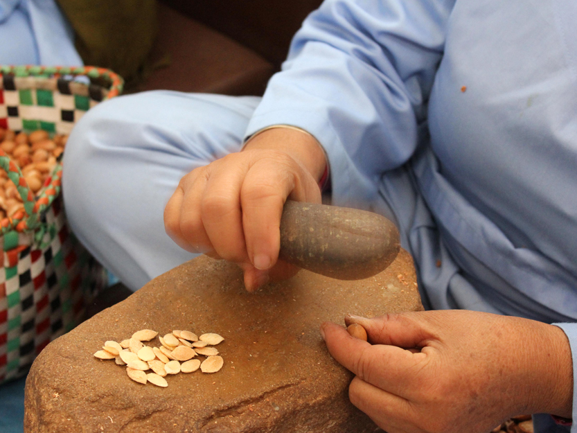
Before leaving Tazarine, consider visiting the traditional house located there. Get back on the P1001 again and then turn right at point: 30.711576, -9.216574 to catch up with the N8 and arrive at Ameskroud which marks the end of the mountain road and the beginning of the Souss Massa plain with its argan forest. You will then exit the N8 on your right at point: 30.602601, -9.345191 to reach the village of Azrarag where you can visit the “Manahil Souss” honey farm (village of Tiwrar 🙂 to discover the local secrets of honey preparation. There is also the possibility to learn about beekeeping. Continue via the P1006, towards the Pays de Mesguina (old caravan route) in the heart of the Arganeraie Biosphere Reserve – Western High Atlas. You can visit the women’s cooperative of Aguerd: extraction of Argan Oil / manufacture of Amlou and take a lunch break. There is a possible hike (in the argan grove) between the village of Azrarag (30.475504, -9.465799) where you will find ancient Saadian tombs as well as the Medersa of Aguerd and the village of Tighanimine (to the south). There is also the possibility of staying in this area rather than returning to Agadir should you wish to do so.
Points of interest:
- Western High Atlas
- Cedar forests / Arganeraie Biosphere Reserve
- Visit of a honey house
- Visit of an Argan Cooperative / Tasting
- Hikes / Treatments / Massage